


Precinct 10-16, Lafourche Parish, Louisiana
About
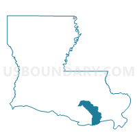
Outline

Summary
| Unique Area Identifier | 589460 |
| Name | Precinct 10-16 |
| County | Lafourche Parish |
| State | Louisiana |
| Area (square miles) | 1.01 |
| Land Area (square miles) | 1.00 |
| Water Area (square miles) | 0.02 |
| % of Land Area | 98.52 |
| % of Water Area | 1.48 |
| Latitude of the Internal Point | 29.56232970 |
| Longtitude of the Internal Point | -90.37136220 |
Maps


Graphs
Select a template below for downloading or customizing gragh for Precinct 10-16, Lafourche Parish, Louisiana


Neighbors
Neighoring Voting District (by Name) Neighboring Voting District on the Map
- Precinct 10-1, Lafourche Parish, LA
- Precinct 10-15, Lafourche Parish, LA
- Precinct 4-6, Lafourche Parish, LA